


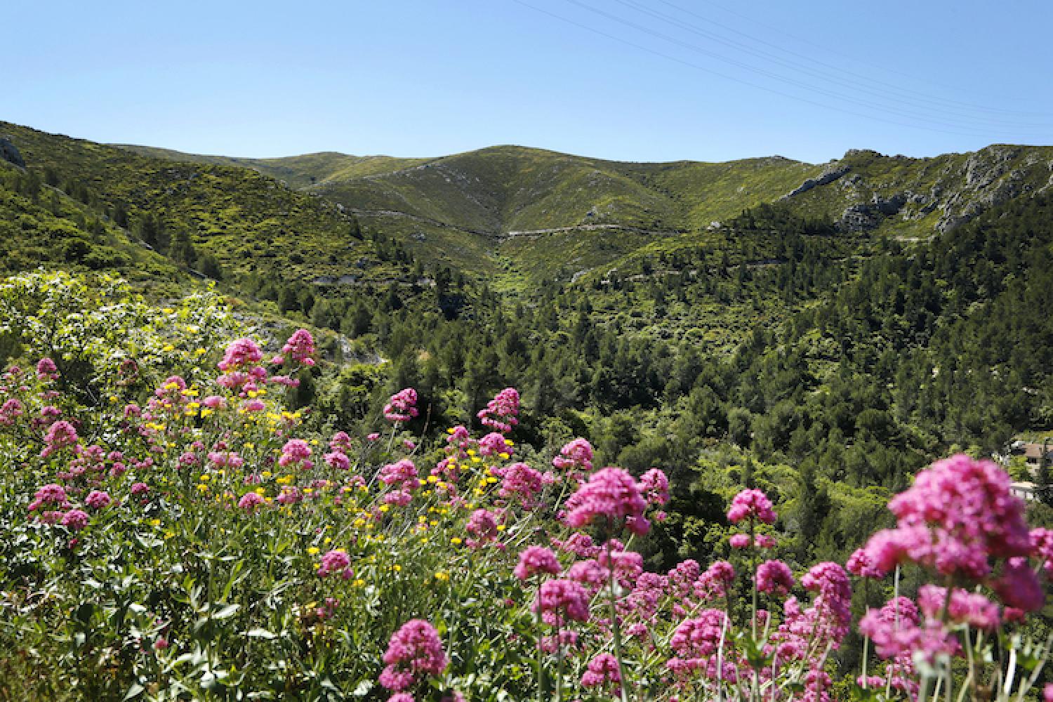
From highland prairies to green valleys
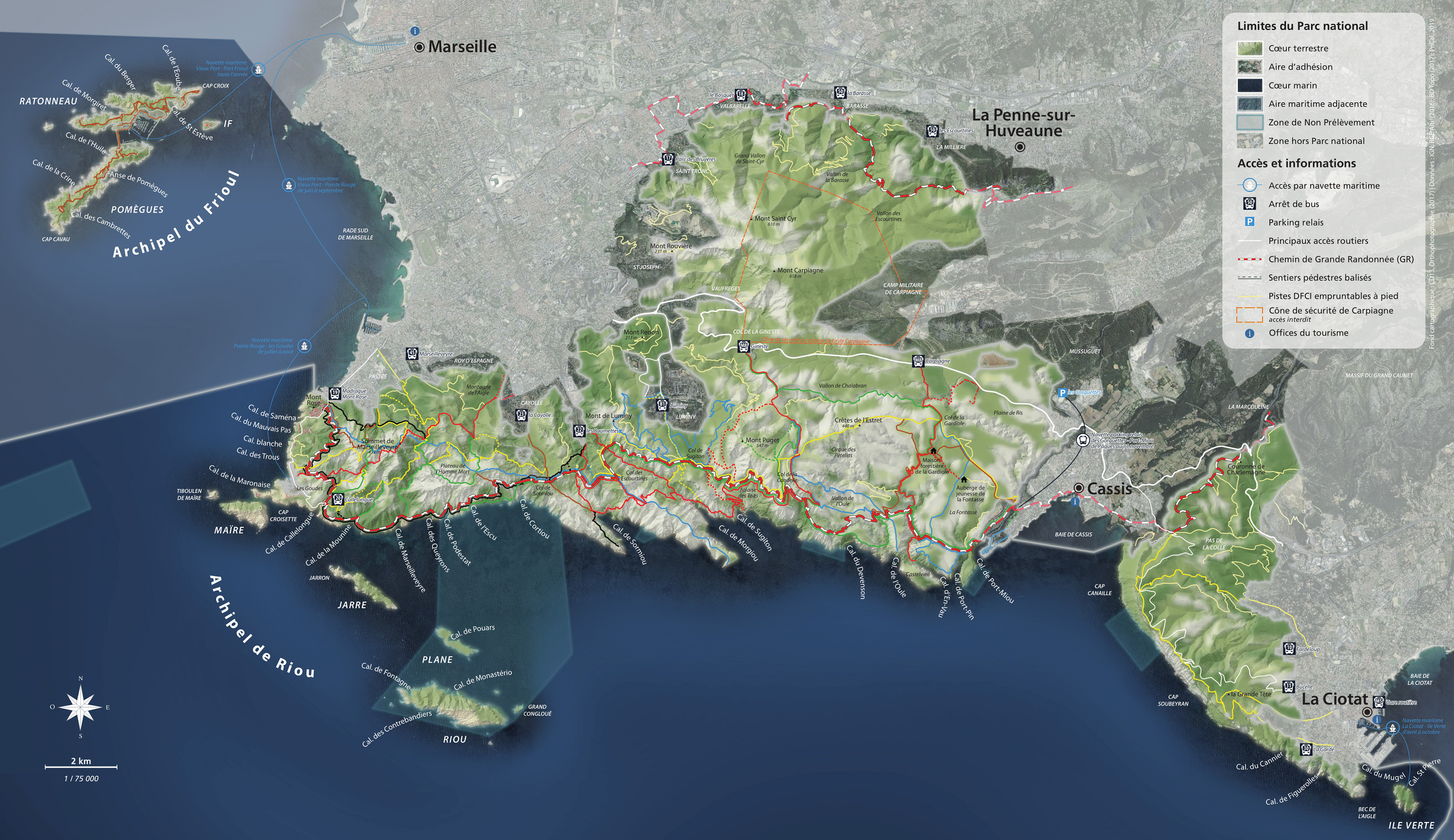
Getting here and regulations
Before heading out to visit the Calanques National Park, make sure you are prepared and read about good conduct and regulations here.
The range is open all year round, except when closed due to fire danger. The Bruyères public park and La Barasse departmental park have paths for lovely walks.
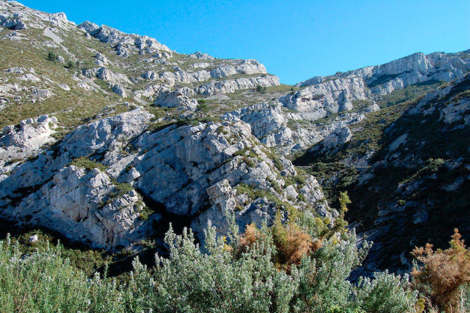
The Muraille de Chine and Toulouse valley are subject to special regulations.
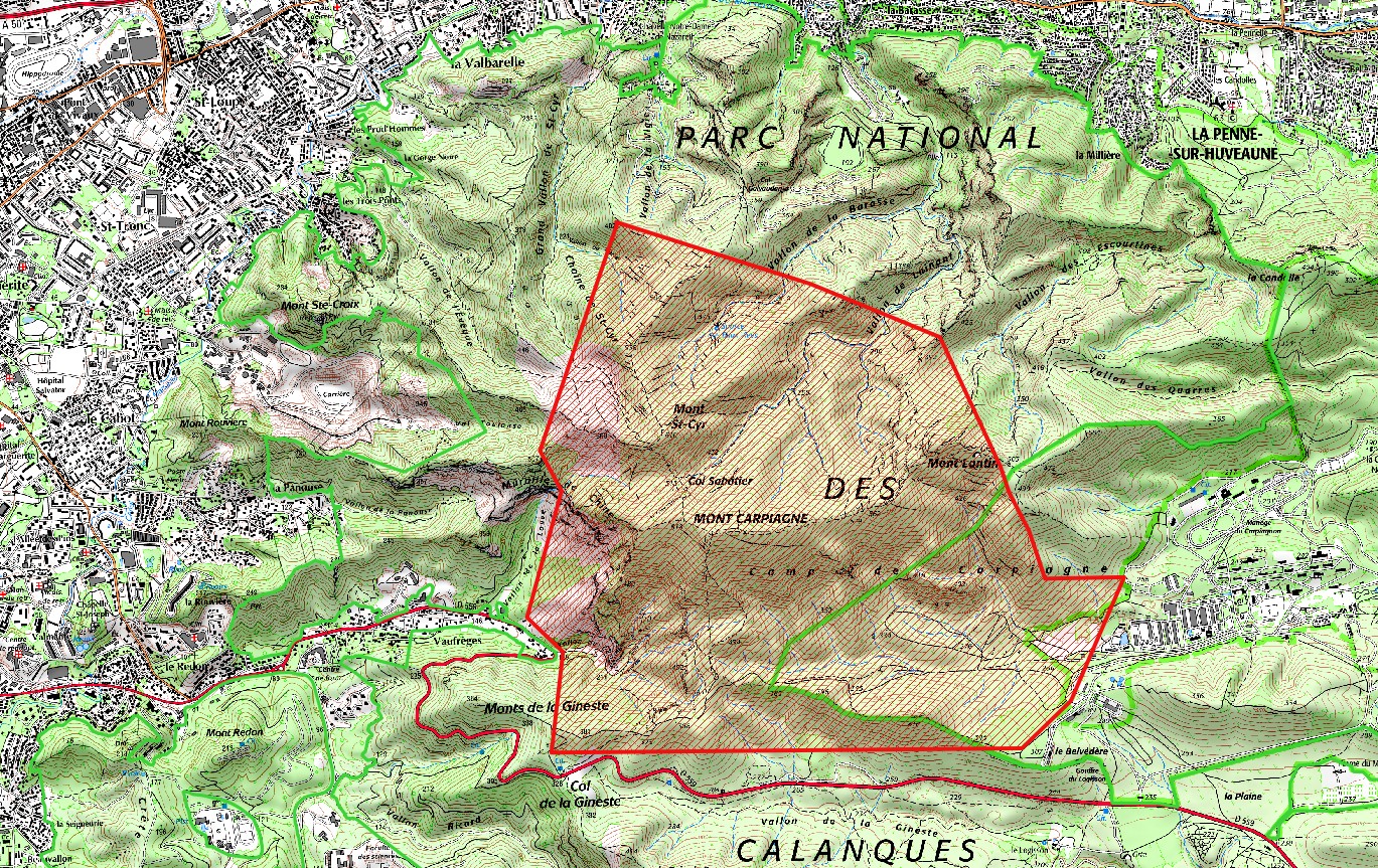
Le versant sud du massif, qui fait partie du terrain militaire du camp de Carpiagne, est interdit d’accès. La zone comprise entre les vallons de Nerte et de la Louve à l’ouest, la sources des Eaux-Vives au nord, le camp de Carpiagne à l’est et la Gineste au sud, classée zone dangereuse et zone de tirs, est également interdite d’accès (voir la carte). Il est donc interdit de faire l’ascension des monts Lantin, Saint-Cyr et Carpiagne.
Acess to the southern slopes of the Saint-Cyr ranges, which are part of Carpiagne military camp, is forbidden. The zone covers the Nerte et La Louve valleys to the west, the Eaux-Vives springs to the north, Carpiagne camp to the west, and La Gineste to the south. To the south, a zone classified as dangerous with a shooting range, is also closed to the public (see the map). As a result, it is forbidden to climb Monts Lantin, Saint-Cyr, and Carpiagne.
Getting here
RTM bus no.17 – direction Parc des Bruyères to the terminus, or no.18 – direction Le Bosquet to the terminus or no.50 – direction Les Escourtines, La Barasse stop or to the terminus. The valleys and northern slopes of the ranges are less than one hour away on foot.
Localisation
GPS coordinates: 43.274458, 5.473084