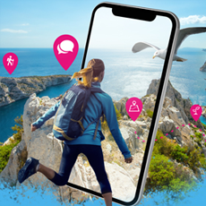

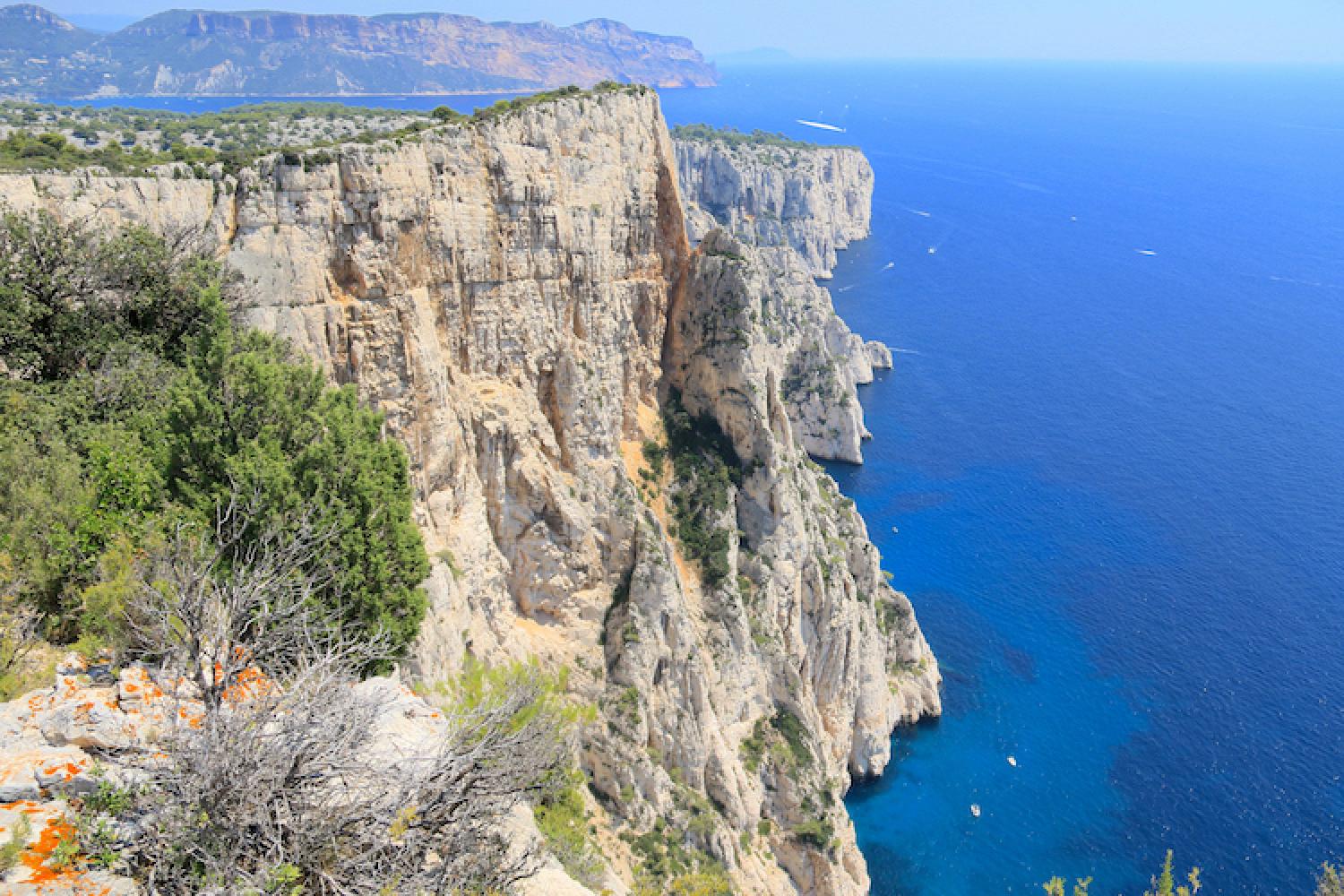
Vertiginous calanques
Facing the sun
The word devenson (devensoun in Provençale) refers to the orientation of the rock face - not to an English-speaking climber as people often think! Facing south, on the slope exposed to the sun for the longest period, you are facing the hill. The suffix -on is typical of Provençale dialect nouns such as agachon, cabanon, Logisson, Sugiton among others.
Highly imaginative landscapes
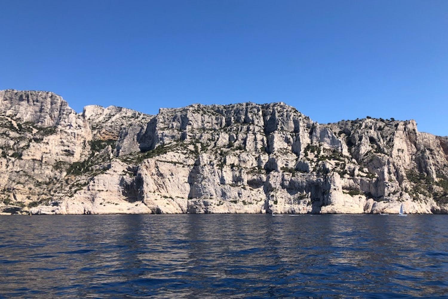
With particularly high rock faces and peaks up to 250 metres plunging directly into the sea with no ledges, the Devenson cliffs were described by the famous landscape gardener Gilles Clément as "landscapes that not even a landscaper would have dared to imagine".
There are several calanques that are not accessible by land, such as Saint-Jean de Dieu and ’Œil de Verre, Devenson, l’Eissadon, l’Oule, and the Enfers and La Baume coves. In Provençale, oule means "cauldron" and baume means "cave". All the names are appropriate descriptions of the chaotic appearance of this wild coastline.
Untouched nature
These limestone formations are home to exceptional biodiversity. The pines clinging to the cliff face, in deep cracks full of earth, are protected from fires and can live to a very old age as a result.
Many birds take refuge here: it is home to many species that favour great open spaces such as the Peregrine falcon and the Eurasian Eagle Owl. Fishing in the sea at the foot of the Devenson cliffs is against the law.
An old forest and farming estate
The Devenson cliffs are part of a much bigger estate: the former farming and forest LaGardiole estate The forest has been State property since 1897 and is managed by the ONF.
This prosperous property with farms and forestry in the hills, is also used by goat farmers with their herds. You might also see lumberjacks, pine tappers, lime burners, coalmen, boilermakers and a range of other gatherers searching for different products in the hills. The valleys are named after these typical Provençale trades.
These activities waned after the destruction of the vineyards by phylloxera at the end of the 20th century, and the subsequent sale of land by their wealthy owners. They have since been replaced by recreational activities: the herdsmen are replaced by hikers and climbers these days!
"Between the water and the sky, the high, white and vertical cliff is the link between the land and the sea."
Getting here and regulations
Before heading out, always prepare your visit and check the page about good conduct and regulations.
The cliffs and surrounding hills are open to visitors all year round, except when closed due to fire danger. The green trail that winds over the top of the cliffs, like a cornice over the sea, features several outstanding lookouts. Shade can be found under the remarkable pine trees. This panoramic trail follows a beautiful old paved cart track which is reinforced by dry-stone walls.
Another way to appreciate the full force of the landscape is to contemplate it from the sea, in a kayak for example.
HIKERS BEWARE: this site can be extremely dangerous. Stay safe: do not leave marked trails. You are putting your life at risk if you go off the trails. The Devenson cliffs are particularly abrupt and brutal winds can cause a deathly fall.
Getting here
RTM bus B1 or 521 in the evening – direction Campus de Luminy, Luminy – PN des Calanques stop, then about 90-minute walk to the Col de Sugiton and Col de La Candelle to approach the Devenson cliffs from the west.
Bus M08:
- La Gineste stop, then about 2-hour walk to the Col de Gineste and Mont Puget to approach the Devenson cliffs from the west.
- Carpiagne Gineste then about 90-minute walk to the Col de la Gardiole to approach the Devenson cliffs from the east.
Localisation
GPS coordinates: from 43.2072381, 5.4784169 to 43.2045616, 5.4886268